Retour aux projets
Géospatial · Fiche projet
Projet QGIS - RGPH 2021
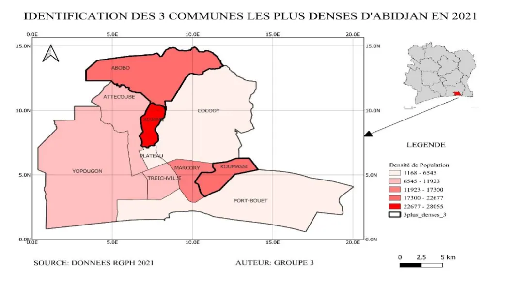
Cartographie et analyse démographique des communes d'Abidjan à partir du RGPH 2021.
QGISCartographieAnalyse spatialeRGPH
01
Contexte & démarche
Cartographie et analyse démographique des communes d'Abidjan à partir du RGPH 2021.
02
Livrables & résultats
Cartes thématiques, analyse spatiale et visualisation de la répartition de population.
03
Technologies
QGISCartographieAnalyse spatialeRGPH